Woop woop! We got the mooring back!
Updated 8-11-2022 with photos during a short visit back to Scott Base
 Happy days! A major and ambitious milestone has been achieved!
Last season, when we were here to test the platelet coring system, we deployed a brand-new type of oceanographic mooring with an experimental design. A 'mooring' just means a string of instruments suspended through the water column and programmed to keep collecting data for as long as possible. This is standard operating procedure for ship-based oceanography but is rather a different prospect in our situation, primarily because we have non-permanent sea ice cover to contend with.
It is usual for us to deploy a mooring, but to only leave it in the water for the period that we're actually in Antarctica conducting the science. We'll drill a hole in the sea ice, mount a tripod over it, then suspend a weighted line with instruments attached down into the water column. When we've completed the rest of the work, we return to the mooring site, melt out the hole around the mooring line, then slowly and very carefully, pull the line up along with the attached instruments and ballast weight.
This method has served us well in the past, with only one major technical challenge: the upper water column is 'supercooled' (below its own freezing temperature), so any equipment suspended in it becomes a site of rapid ice formation. In our first experience of this, back in 2007, it only took three days before the ice growth was sufficient to overcome the weight of the mooring itself (well over 100 kgs) and the whole lot began to drift upwards through the water column.
And where we work, the equipment doesn't just politely sit under the sea ice waiting to be collected. Rather, it becomes embedded in the layer of platelet crystals, gathering more and more ice, with the potential to become impossible to recover. To date, we have managed to recover every mooring deployed in this manner, although some instances have required a fair amount of creative thinking on the fly! But the major issue remains: this method only allows us to collect ocean data during the period that we're actually here doing the mahi. Hence, our understanding of the processes is heavily skewed towards October and November.
What we really need is the ability to collect data all year round. But in this, the stable and convenient platform of the sea ice, which serves us well in October and November, is no longer our friend… We can't leave instruments suspended from the ice surface in the normal way, because when the sea ice breaks up and floats away, it will take all of our equipment with it.
Instead, we need a method that allows us to anchor the mooring on the seabed in the manner of more typical ship-based oceanographic deployments. But for our situation, we hit two snags:
i) unlike a ship-based deployment, when we return to collect the gear, the ocean will once again be covered with ice so we can't bring a ship in to employ the usual recovery methods. Besides, vessel access into McMurdo Sound is difficult to obtain at the best of times, but with the advent of covid-19, what access we might have had has been all but completely scuppered.
ii) We cannot have our instrumented line stretching all the way to the surface – which would make finding it again much simpler – because if it extends into supercooled water, it'll grow ice. Over the course of a whole year, we can expect so much ice growth that it could lift any amount of ballast that we could reasonably deploy, allowing the mooring to simply drift away. Hence our top-most item can be no higher than 70 m below the sea ice.
So, my long-time colleague and Antarctic moorings master, Brett Grant, came up with an ingenious design… In the manner of ship-based deployments, we have a heavy anchor sitting on the seabed and the line holding the instruments has floats along it so that the string sits upright in the water. Then comes the new bit: the upper-most component is comprised of a set of floats and a canister of coiled rope. When the signal is sent from the surface, the coil of rope is released, and the floats rise to the surface. We 'simply' drill a hole in the sea ice in the right spot, collect the floats, canister and rope, then pull the whole lot up.
But nothing in the recovery process is simple. We embark on four critical phases, which ideally need to be completed in a single day to minimise the risk of freezing in. Thankfully, the weather dawned clear, relatively warm, and critically, still, on the appointed day. The best possible conditions for completing a long and tricky task.
Phase 1: Establish an acoustic connection with the release system. This will tell us whether the mooring is still sitting where we left it, and that the batteries on the release unit, at least, have survived the year. This required a 30-minute drive across the sea ice to reach the mooring site. Then we drilled a hole through the sea ice with a 'Jiffy' drill (essentially a post-hole borer), requiring multiple stops/starts as we had to keep adding sections (AKA 'flights') to have enough length to get through the sea ice. This loosens the very top layer of platelet crystals, which the float up the hole and we're able to scoop them out with a kitchen sieve. But we have to clear *all* of the platelets in order to be able to drop any equipment through. So, a heavy weight on a rope is repeatedly dropped into the hole to 'bust' up the layer. This results in a cascade of crystals that float up into the hole, requiring much scooping out. Finally, the hole is ready, and the acoustic transducer is lowered through. The signal is sent, and a return signal is received from the mooring. It's still alive, and it's still where we left it!
Phase 2: Use 3-dimensional triangulation to work out where the mooring is sitting. Now we drill and clear three further holes, lowering the transducer down, and determining the range between the hole and the mooring from each. The intersection of the four 'range circles' gives us the location of the release unit in 3-dimensional space. With this result in hand, we were confident that the mooring would 'surface' somewhere in the immediate vicinity, and the 'release' signal was sent. By continuing to query the range of the instrument, we could 'watch' it slowly ascend through the water column. Once it's range ceases changing, we knew that it had risen up to settle against the base of the platelet layer. Another round of querying the range from the four pilot holes gave us the location to drill (a fifth hole) where we could *hopefully* catch hold of the floats and canister unit.
Phase 3: Snagging the line. Next, we put a camera down with a live feed so that we could get eyes on the mooring. Rotating through 360 degrees gave us a visual (a very exciting moment). But with the camera's fisheye lens, it was difficult to ascertain which distance and direction we should aim for. Nonetheless, the grappling tool (large hooks on the end of a bendy pole, manipulated with a secondary rope) was lowered into the hole and an attempt made to snag the line. Working blind, this was a near-impossible task. So, a new hole (#6) was drilled close-by to give us visual feedback on the process which was otherwise hidden beneath our feet. We drilled this sixth hole at our best guess for where the floats had come up from the previous camera deployment. But we found we were essentially 180 degrees out! Keeping the live camera feed going, we then started drilling more holes, to drop a chain down (which would appear in the camera's view) and finally work out where the floats
had come up. Miraculously, the very first of these (hole #7) had the chain falling through directly on top of the floats and rope canister. We had pin-pointed the mooring location! We widened the hole and sent the ballast weight down to break up the platelets. At that point, the weight got snagged (on some component of the mooring) and could not be brought up again. A bit of jiggling of that line, and suddenly water erupted from the hole, closely followed by the first of the mooring's floats. We had the top of the mooring in hand!
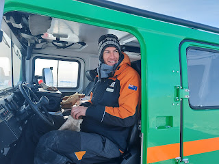
Phase 4: Recover the mooring. No time to lose now, because the floats (of which there were several spread over the length of the line) were only 1 cm narrower that the Jiffy hole. So, any re-freeze of the hole would prevent recovery altogether. The tripod was set up and secured over the hole and the mooring line secured to the front of the Hagglunds vehicle. My job was then to slowly reverse the Hagglunds, drawing the line up and out of the water, and stopping as required for the rest of the team to manipulate the various mooring components and recover the instruments.
 A flag signalling system worked well for this, and the entire line was recovered without incident. By now, though, the sun was low in the sky and a sneaky breeze had got up. The last part of the process was pretty cold for the guys working around the hole, and they needed a break mid-way to rest and warm up. Eventually, at the end of a solid 10-hour day, the final components were recovered, the site packed up, and we were free to drive back to camp.
It was an exhausting effort (especially for the others) but thoroughly rewarding. This triumphant achievement is testament to Brett's extensive skill and experience, and a culmination of his careful planning over the past ~3 years. It was a joy for me to witness the teamwork and skill in action as Brett, Craig, Greg, and Ollie together worked the ropes as a smooth unit. It was utterly delightful that the whole process came together so well on what is likely to be Brett's last day in the Antarctic field. A fitting end to a wonderful era of working together.
Sent from Iridium Mail & Web.

 Happy days! A major and ambitious milestone has been achieved!
Last season, when we were here to test the platelet coring system, we deployed a brand-new type of oceanographic mooring with an experimental design. A 'mooring' just means a string of instruments suspended through the water column and programmed to keep collecting data for as long as possible. This is standard operating procedure for ship-based oceanography but is rather a different prospect in our situation, primarily because we have non-permanent sea ice cover to contend with.
It is usual for us to deploy a mooring, but to only leave it in the water for the period that we're actually in Antarctica conducting the science. We'll drill a hole in the sea ice, mount a tripod over it, then suspend a weighted line with instruments attached down into the water column. When we've completed the rest of the work, we return to the mooring site, melt out the hole around the mooring line, then slowly and very carefully, pull the line up along with the attached instruments and ballast weight.
This method has served us well in the past, with only one major technical challenge: the upper water column is 'supercooled' (below its own freezing temperature), so any equipment suspended in it becomes a site of rapid ice formation. In our first experience of this, back in 2007, it only took three days before the ice growth was sufficient to overcome the weight of the mooring itself (well over 100 kgs) and the whole lot began to drift upwards through the water column.
And where we work, the equipment doesn't just politely sit under the sea ice waiting to be collected. Rather, it becomes embedded in the layer of platelet crystals, gathering more and more ice, with the potential to become impossible to recover. To date, we have managed to recover every mooring deployed in this manner, although some instances have required a fair amount of creative thinking on the fly! But the major issue remains: this method only allows us to collect ocean data during the period that we're actually here doing the mahi. Hence, our understanding of the processes is heavily skewed towards October and November.
What we really need is the ability to collect data all year round. But in this, the stable and convenient platform of the sea ice, which serves us well in October and November, is no longer our friend… We can't leave instruments suspended from the ice surface in the normal way, because when the sea ice breaks up and floats away, it will take all of our equipment with it.
Instead, we need a method that allows us to anchor the mooring on the seabed in the manner of more typical ship-based oceanographic deployments. But for our situation, we hit two snags:
i) unlike a ship-based deployment, when we return to collect the gear, the ocean will once again be covered with ice so we can't bring a ship in to employ the usual recovery methods. Besides, vessel access into McMurdo Sound is difficult to obtain at the best of times, but with the advent of covid-19, what access we might have had has been all but completely scuppered.
ii) We cannot have our instrumented line stretching all the way to the surface – which would make finding it again much simpler – because if it extends into supercooled water, it'll grow ice. Over the course of a whole year, we can expect so much ice growth that it could lift any amount of ballast that we could reasonably deploy, allowing the mooring to simply drift away. Hence our top-most item can be no higher than 70 m below the sea ice.
So, my long-time colleague and Antarctic moorings master, Brett Grant, came up with an ingenious design… In the manner of ship-based deployments, we have a heavy anchor sitting on the seabed and the line holding the instruments has floats along it so that the string sits upright in the water. Then comes the new bit: the upper-most component is comprised of a set of floats and a canister of coiled rope. When the signal is sent from the surface, the coil of rope is released, and the floats rise to the surface. We 'simply' drill a hole in the sea ice in the right spot, collect the floats, canister and rope, then pull the whole lot up.
But nothing in the recovery process is simple. We embark on four critical phases, which ideally need to be completed in a single day to minimise the risk of freezing in. Thankfully, the weather dawned clear, relatively warm, and critically, still, on the appointed day. The best possible conditions for completing a long and tricky task.
Phase 1: Establish an acoustic connection with the release system. This will tell us whether the mooring is still sitting where we left it, and that the batteries on the release unit, at least, have survived the year. This required a 30-minute drive across the sea ice to reach the mooring site. Then we drilled a hole through the sea ice with a 'Jiffy' drill (essentially a post-hole borer), requiring multiple stops/starts as we had to keep adding sections (AKA 'flights') to have enough length to get through the sea ice. This loosens the very top layer of platelet crystals, which the float up the hole and we're able to scoop them out with a kitchen sieve. But we have to clear *all* of the platelets in order to be able to drop any equipment through. So, a heavy weight on a rope is repeatedly dropped into the hole to 'bust' up the layer. This results in a cascade of crystals that float up into the hole, requiring much scooping out. Finally, the hole is ready, and the acoustic transducer is lowered through. The signal is sent, and a return signal is received from the mooring. It's still alive, and it's still where we left it!
Phase 2: Use 3-dimensional triangulation to work out where the mooring is sitting. Now we drill and clear three further holes, lowering the transducer down, and determining the range between the hole and the mooring from each. The intersection of the four 'range circles' gives us the location of the release unit in 3-dimensional space. With this result in hand, we were confident that the mooring would 'surface' somewhere in the immediate vicinity, and the 'release' signal was sent. By continuing to query the range of the instrument, we could 'watch' it slowly ascend through the water column. Once it's range ceases changing, we knew that it had risen up to settle against the base of the platelet layer. Another round of querying the range from the four pilot holes gave us the location to drill (a fifth hole) where we could *hopefully* catch hold of the floats and canister unit.
Phase 3: Snagging the line. Next, we put a camera down with a live feed so that we could get eyes on the mooring. Rotating through 360 degrees gave us a visual (a very exciting moment). But with the camera's fisheye lens, it was difficult to ascertain which distance and direction we should aim for. Nonetheless, the grappling tool (large hooks on the end of a bendy pole, manipulated with a secondary rope) was lowered into the hole and an attempt made to snag the line. Working blind, this was a near-impossible task. So, a new hole (#6) was drilled close-by to give us visual feedback on the process which was otherwise hidden beneath our feet. We drilled this sixth hole at our best guess for where the floats had come up from the previous camera deployment. But we found we were essentially 180 degrees out! Keeping the live camera feed going, we then started drilling more holes, to drop a chain down (which would appear in the camera's view) and finally work out where the floats
had come up. Miraculously, the very first of these (hole #7) had the chain falling through directly on top of the floats and rope canister. We had pin-pointed the mooring location! We widened the hole and sent the ballast weight down to break up the platelets. At that point, the weight got snagged (on some component of the mooring) and could not be brought up again. A bit of jiggling of that line, and suddenly water erupted from the hole, closely followed by the first of the mooring's floats. We had the top of the mooring in hand!

Phase 4: Recover the mooring. No time to lose now, because the floats (of which there were several spread over the length of the line) were only 1 cm narrower that the Jiffy hole. So, any re-freeze of the hole would prevent recovery altogether. The tripod was set up and secured over the hole and the mooring line secured to the front of the Hagglunds vehicle. My job was then to slowly reverse the Hagglunds, drawing the line up and out of the water, and stopping as required for the rest of the team to manipulate the various mooring components and recover the instruments.

It was an exhausting effort (especially for the others) but thoroughly rewarding. This triumphant achievement is testament to Brett's extensive skill and experience, and a culmination of his careful planning over the past ~3 years. It was a joy for me to witness the teamwork and skill in action as Brett, Craig, Greg, and Ollie together worked the ropes as a smooth unit. It was utterly delightful that the whole process came together so well on what is likely to be Brett's last day in the Antarctic field. A fitting end to a wonderful era of working together.
Sent from Iridium Mail & Web.


Comments
Post a Comment